Introduction
Following public consultation in 2022/23, award-winning housebuilder, Redrow, has submitted a planning application to deliver a new neighbourhood of high-quality homes, set within extensive areas of landscaped public open space at land south of Burbage.
The plans will provide a mix of high-quality homes ranging from 1 to 5 bedrooms, affordable homes for key workers and local first-time buyers, as well as bungalows, a care home, and dedicated self-build plots enabling people to construct their own homes to their own needs and specifications.
The new residential neighbourhood will be responsive to its surroundings, being set within a comprehensive network of ecological and wildlife corridors focussed around existing linear site features such as watercourses, hedgerows and public rights of way. Connectivity through the Site and to the village and surroundings will be emphasised with a new network of walking and cycling routes to encourage sustainable travel.
The site
The site measures approximately 27 hectares and is located between the southern extent of Burbage and the M69 motorway. The site adjoins the existing settlement of Burbage to the north and east. To the north-east and west is agricultural land and to the south is the M69 forming a barrier to the open countryside beyond.
The site is sustainably located on the edge of Burbage, which is one of the four main urban areas of the Borough, with access to a range of facilities, providing a mix of shops, restaurants and pubs, banks and markets. The site is also well-served by public transport, with the Bus Stops on Coventry and Lutterworth Road, providing access to Burbage and Hinckley town centre. In essence, Burbage is one of the most sustainable locations for growth within Hinckley and Bosworth Borough.
There are a number of permitted and proposed developments in the immediate vicinity of the site, as well as sites identified in Hinckley and Bosworth Borough Council’s Strategic Housing and Employment Land Availability Assessment (SHELAA) as being suitable for residential development.
The southeastern parcel of the site, southwest of Lutterworth Road, has an existing outline planning permission in place for up to 80 homes. 55 of the proposed 422 homes will be provided on this parcel.
Site location plan - click to enlarge
The development proposals
Redrow has submitted a hybrid planning application for the creation of a new neighbourhood of 422 high quality homes set within extensive areas of landscaped public open space. In line with local planning policy, 20% of the new homes will be affordable homes for local key workers, first-time buyers and those on lower incomes. Bungalows are also included as part of the mix of homes, and 54% of the new homes will be adaptable dwellings to meet the changing needs of householders.
The plans include 11 self-build plots enabling people to design and build their own homes tailored to their own needs and aspirations.
In addition to new homes, a care home is also proposed. This element of the application is outline, providing flexibility for a care home operator to submit detailed plans tailored to their operational requirements.
Existing trees and hedgerows across the site will be retained wherever practicable, with habitats being enhanced with additional planting within the extensive areas of green public open space. This will create a comprehensive network of ecological and wildlife corridors.
Public rights of way will be enhanced, including improvements to the Burbage Round, alongside the creation of a network of new footpaths and cycleways connecting the new neighbourhood with the existing residential areas to the north and east of the site, and providing links onwards to the shops, restaurants and facilities of the village centre.

Development masterplan - click to open
The hybrid planning application
- Full planning for 422 high-quality new homes comprising a mix of types and sizes, ranging from 1 bedroom maisonettes to 5 bedroom family homes
- 20% affordable housing for local key workers, first-time buyers and local people on low incomes.
- The delivery of homes that are capable of adaption to meet the changing needs of householders including some older people and those with mobility issues.
- Providing new bungalows as part of the mix of homes
- Outline planning for a new care home to meet the needs of older people (Outline to provide flexibility for the care home operator to submit detailed designs tailored to their requirements)
- Outline planning for 11 self-build plots (Outline to provide flexibility for self-builders to submit their own detailed designs tailored to their needs and aspirations)
- Retention and enhancement of public rights of way, including the Burbage Round.
- A network of new footpaths and cycleways connecting the new neighbourhood to adjoining neighbourhoods and providing links on into Burbage village centre.
- Over a third of the new neighbourhood retained as green public open space, including retention and enhancement of existing green corridors, retention of existing trees and hedgerows within the site wherever possible, and extensive new planting of trees and hedgerows.
- A commitment to delivering Biodiversity Net Gain within the new neighbourhood.
- Noise mitigation measures to protect residential amenity, such as from traffic-related noise from the M69 motorway to the south.
- Provision of ultra–fast broadband to all new homes.
- Dedicated study space within some new homes to facilitate the growing trend for home working.
- EV Charging infrastructure provided to all new homes as standard.
- Significant financial contributions to local services and facilities, including schools, healthcare provision and public transport, , with anticipated expenditure including:
- c£2.2 million on Primary Education
- c£1.2 million on Secondary Education
- c£600,000 on Early Years provision
- c£250,000 on Post-16 education
- c£220,00 on SEND provision
- £330,000 on local GP provision
Local planning policy
The Burbage Neighbourhood Plan 2015- 2026 was formally made by the Council on 10 May 2021, following a local referendum supporting the plan, and it now forms part of the Development Plan for Hinckley and Bosworth Borough. Policy 1 (Settlement Boundary) of the NP is clear that “Residential development on land within or adjacent to the settlement boundary, as shown on Figure 2, page 19 will be supported, subject to complying with other development plan policy.” Although the site is beyond the Burbage Settlement Boundary, it does adjoin it at several points. In this context, the principle of residential development is clearly supported by the Burbage Neighbourhood Plan.
In addition to according with the Neighbourhood Plan, the plans are policy compliant in other respects, including provision of affordable homes, provision of public open space, development density, housing mix and design.
Local infrastructure
The development proposals will generate significant constributions to support local infrastructure to ensure that capacity of local services is increased to accommodate the new neighbourhood. The level of investment required is determined by the Local Authority in consultation with statutory consultees including the Local Education Authority, local NHS Integrated Care Board, and others.
This process is ongoing, however the following financial constributions have so far been suggested through consultation to be provided by the development:
- Nearly £2.2 million to increase capacity in local Primary Education
- Circa £1.2 million on capacity in local Secondary Education
- More than £600,000 for Early Years provision
- Around £250,000 for Post-16 education locally
- More than £220,000 for SEND provision
- Circa £330,000 to support local GP provision
- Over £12,500 to be invested in Burbage Library
- Over £21,000 on improving facilities at the local Household Waste and Recycling Centre
House types and design
The design of the different house types incorporates traditional architectural elements into a modern home. The houses have traditional pitched roofs, with some side gables, facing the adjacent dwellings, and some fronting the street, resulting in a varied roof form and shape, which break up the massing and scale within a varied street scene.
In order to complement the existing local vernacular, the house types from the Redrow Heritage range have been utilised, which include a range of architectural detailing.
Examples of Redrows’ house types can be seen in the image gallery below:


House frontages have been carefully designed with generous windows from habitable rooms, clearly defined and attractive front doors and planting to act as a buffer between the pavement and window.
Internal habitable rooms have been designed to have appropriate levels of natural daylight and connect well to external private gardens.
Affordable housing is well-integrated with a tenure blind approach so there is no discernible difference between private and affordable dwellings.
M4(2) compliant dwellings (Adaptable Homes) and bungalows are included in the housing mix along with self-build areas and a care home. The self-build and care home elements of the planning application are Outline, giving the care home operator and self-builders the flexibility to submit their own detailed design proposals in due course.
The design of the layout intends to create an attractive and cohesive development, but within it there will be areas and spaces with distinctly different characters and identities. This approach allows the design to reflect varying site characteristics and creates a more interesting place with a range of experiences for residents and visitors alike. Five distinct character areas are proposed, created through subtle variation in the density of homes and their layout, the design of buildings and streets, surrounding uses and particularly the landscape setting. This will make them attractive places to live and help to build a sense of community.
Examples of proposed street scenes from the development - click to enlarge
Green open space
The delivery of well-designed accessible and inclusive public spaces will offer residents spaces to socialise and engage with each other, encouraging interaction and opportunities to benefit from healthy lifestyle choices.
A number of areas of public open spaces are proposed within the development.
This includes (refer to plan below):
- CENTRAL GREEN SPACE. The Central Green space will become a focal point within the development. Located at the heart of the scheme, this space will incorporate a play area, the existing Burbage Round public right of way, and retained hedgerows defining its boundary and be accessible by all residents.
- SOUTHERN GREEN SPACE. The southern green space provides a large open green area, with a Multi Use Games Area (MUGA) and play area, linked by a series of footpaths providing a pedestrian network throughout the site. The bund on the southern boundary provides a visual and acoustic barrier from the M69 creating a natural landscaped zone.
- SUDS. Sustainable urban drainage is integrated into the proposed layout through the drainage ponds, located at the lowest point of the Site. These are situated adjacent to the watercourse which runs across the Site from the north-west to the south-east. These are appropriately planted ensuring they are part of the overall planting strategy and integrate well within the landscape, providing new wetland habitats to enhance the biodiversity value of the site.
- ORCHARD. A formal orchard has been located in the northern corner of the Site. It is a natural high point within the scheme, providing a natural landscape zone between the residential parcels and the land to the east along the Site boundary.
- DEVELOPMENT EDGE Development is set back form the edges of the Site creating a soft edge so that it integrates well into the surrounding landscape. This provides opportunities to retain existing planting, provide hedge hedgerows and trees, and encourage use of the public open space via the proposed pedestrian route that runs around the perimeter. This space is overlooked by the proposed dwellings ensuring it is safe and encourages its use.
- LAP/TRIM TRAIL Trim trail equipment is used to create an exciting outdoor trail of activities for children and adults to walk, climb, and more, to get along the trail to the other side. These are interspersed throughout the public open space.
This plan provides an overview of the areas of Public Open Space shown in green and blue, totalling 25.93 acres – click to enlarge
Access and movement
The neighbourhood will be served by a primary access from Coventry Road. The access from Coventry Road is being facilitated by the removal of two properties owned by Redrow.
A small section of the development comprising 55 homes to the east of the site will have a dedicated access on to Flanders Close but there will be no vehicular link between this parcel and the main site. There will therefore be no vehicular link between Flanders Close and Coventry Road, but there will be pedestrian and cycling links. The access from Coventry Road is being facilitated by the removal of two properties owned by Redrow.
The access from Coventry Road forms the spine road into the site and will be designed as a tree-lined Avenue, facilitating bus access. Initial discussions have been held with Arriva who have confirmed interest in diverting their existing services into the development. The spine road will be bordered by a 2m footway and 3m cycleway.
The neighbourhood has also been designed to provide the potential for an additional vehicular access to Rugby Road, west of the site, as part of any future development in that area.
A detailed Transport Assessment has been produced as part of a planning application in line with current government and local policy guidance. This report assesses the highway safety and capacity of the surrounding highway network and demonstrates that access from Coventry Road can be safely accommodated without detrimentally impacting the surrounding highways network. The Coventry Road access has also been subject to an independent safety audit.
There is an Outline Planning Consent in place for up to 80 homes on the southeastern parcel of the site off Flanders Close. 55 of the proposed 422 will be delivered on this parcel. Access to this parcel of 55 homes will be from Flanders Close, but there will be no vehicular connection between this parcel of homes and the rest of the site. There will only be pedestrian and cycle connectivity between Ambion Way and Coventry Road with no vehicular connection.
Pedestrian and cyclist access is retained to Workhouse Lane encouraging walking and cycling trips to the local area alongside a network of footpaths through the development itself.
Movement plan - click to enlarge
Key environmental and technical matters
The planning application for the proposed new neighbourhood addresses several important environmental and technical matters, demonstrating that the proposed development is suitable, sustainable and will not give rise to environmental harm.
Redrow appointed an experienced technical team to review key environmental and technical issues in the preparing the planning application, including:
Trees and hedgerows
An Arboricultural Assessment was undertaken which assessed trees along and within the boundaries of the site, along with a number of hedgerows. These existing natural assets will be retained and protected as part of the emerging proposals.
The only removal of existing hedgerows and trees that will be required relates to facilitating the vehicular access from Coventry Road, along with the internal highway network. However, the development will also include the extensive planting of new trees and hedgerows planting within the open space and along boundaries. The proposed development provides an opportunity to improve and increase tree cover in the local area without the loss of any arboriculturally significant trees or hedgerows.


Ecology and biodiversity
An Ecological Appraisal of the site was undertaken to help inform the masterplan. The appraisal identified that the site comprises eight improved agricultural grassland field compartments, with a smaller area of marshy grassland recorded adjacent to the brook which runs from west to east through part of the site, and then southwards along the western boundary. Most field compartments were enclosed by hedgerows, with several hedgerows encompassing mature trees. Additional habitats present include small areas of dense and scattered scrub and tall ruderal vegetation. The improved agricultural grassland is of low ecological value. Due to the scale of the site, the overall ecological value of the site can be improved through the creation of public open space to enhance biodiversity within the site by introducing diverse native planting and creation of wetland features which have higher ecological value than agricultural grassland. In addition, the planting and landscaping strategy for the new neighbourhood provides opportunities to buffer and enhance the value of retained habitats by improving the overall habitat connectivity across the site.
The Appraisal made several recommendations for biodiversity enhancement on site, including new bird and bat boxes and a bat-friendly lighting scheme. Areas of open space will be seeded and managed in the long term as native wildflower meadows. Redrow are excited to include these features in the proposed development and is committed to ensuring that the new neighbourhood will deliver biodiversity net gain.
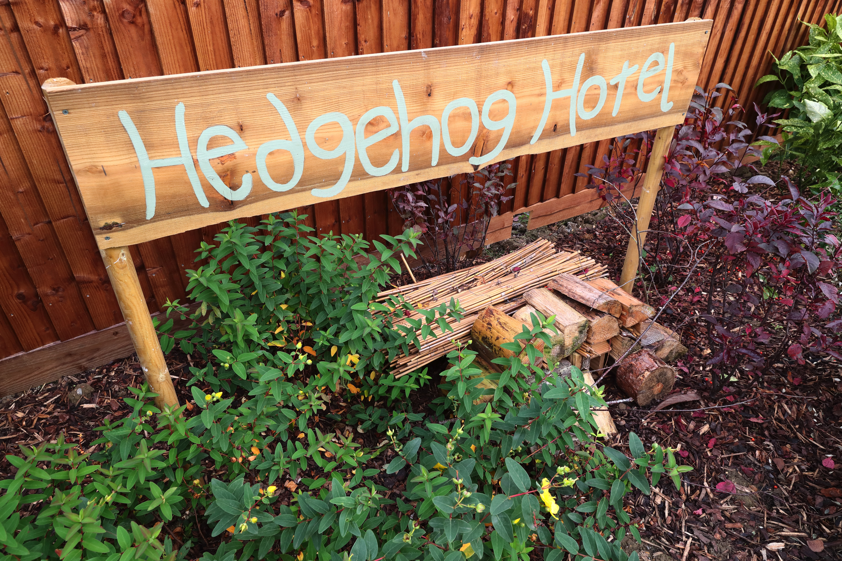
Hedgehog hotel - click to enlarge
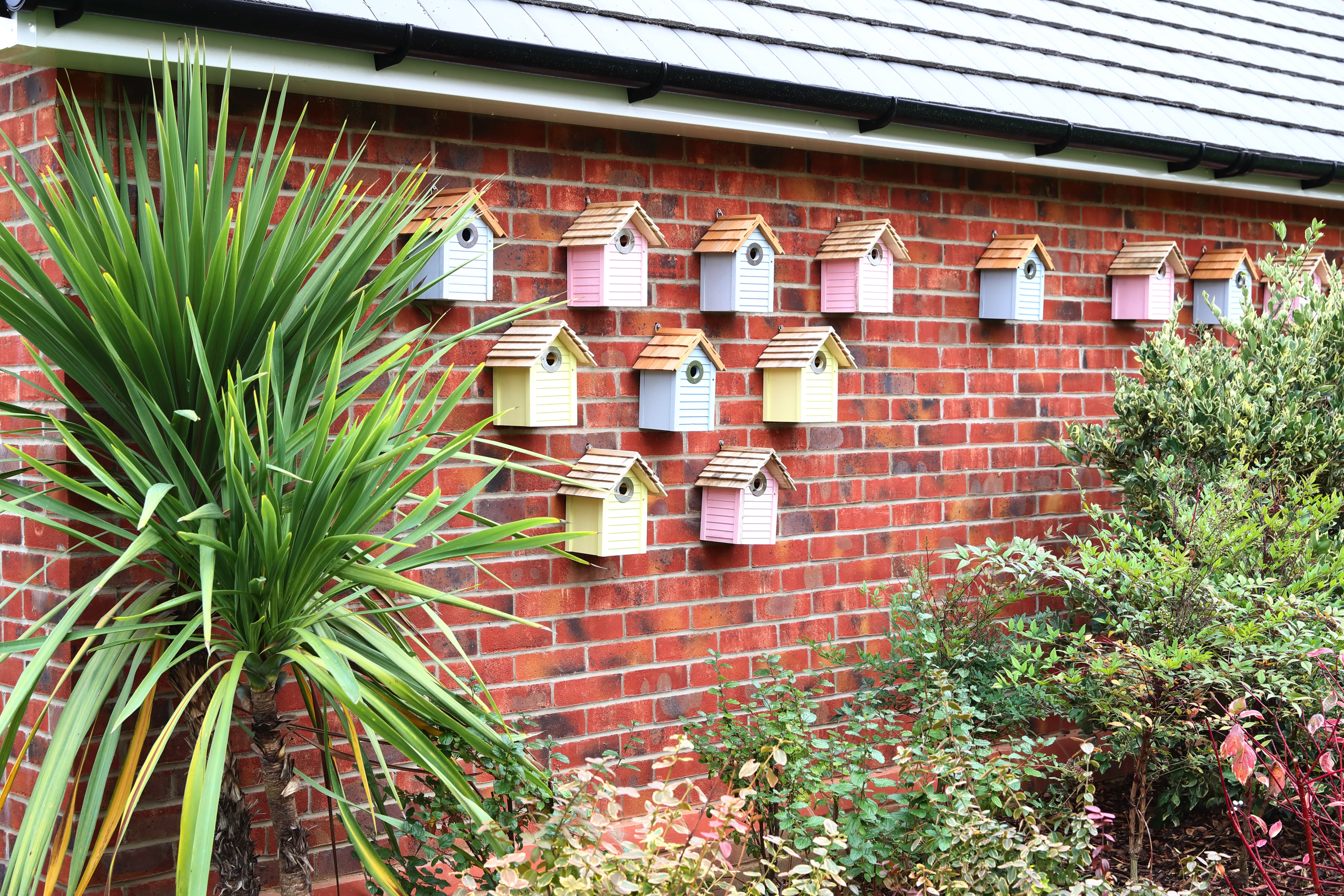
Bird boxes - click to enlarge

Bat house - click to enlarge
Air quality
A full Air Quality Assessment is included within the planning application.
Flooding and drainage
A Drainage Strategy and Flood Risk Assessment was prepared for the development of the site. The Environment Agency Flood Maps confirm that the site is located within Flood Zone 1 (lowest risk of flooding).
Surface water discharge will be kept at the existing Greenfield Runoff rates to ensure that the proposed development remains safe and does not increase flood risk or incur any adverse impacts on the surrounding area.
Existing surface water flooding associated with a watercourse crossing part of the site has was identified and a Drainage Strategy prepared. This incorporates Sustainable Drainage Systems (SuDS) and which will assist in managing and improving the existing surface water situation. The incorporation of SuDS also plays a dual role, as it will be incorporated into the site’s public open space, offering many environmental benefits such as the creation of wetland habitat, and provides amenity value to the proposed public open space.

An example of a Sustainable Drainage System (SuDS) on a Redrow development - click to enlarge
Noise
The southern area of the site takes into account noise from the adjoining M69. A Noise Survey and Assessment was undertaken which identifies mitigation measures including an appropriate separation distance between the motorway and the nearest dwellings, along with site layout optimisation. An acoustic barrier is also proposed along the southern boundary adjacent to the M69. The required mitigation measures identified will be fully implemented into the scheme proposals.

The site's relationship with the M69 - click to enlarge
Heritage and archaeology
There are no designated or non-designated heritage assets within the site boundary, nor are there Conservation Areas or Listed Buildings in close proximity to the site, with the Burbage Conservation Area located 800-1000m from the site and the nearest listed building located c.800m from the site, screened from view by the M69 which forms a visual barrier between them.
An Archaeological Desk-Based Assessment was undertaken which confirmed that there are no designated assets of an archaeological nature – Scheduled Ancient Monuments, Registered Parks and Gardens or Battlefields – within the boundary of the site.
Planning application documents
You can view the planning application documents on Hinckley and Bosworth Borough Council’s planning website here.
The most accessible report, which provides an overview of all aspects of the proposed development is the Design & Access Statement. You can download a copy of the Design & Access Statement here.
If you have any comments or questions about the planning application or the proposed development, please get in touch with us via our contact form or email us directly at hello@redrow-burbage.com.